


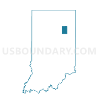
HUNTINGTON 05A, Huntington County, Indiana
About
Outline

Summary
| Unique Area Identifier | 577886 |
| Name | HUNTINGTON 05A |
| County | Huntington County |
| State | Indiana |
| Area (square miles) | 0.39 |
| Land Area (square miles) | 0.39 |
| Water Area (square miles) | 0.00 |
| % of Land Area | 99.99 |
| % of Water Area | 0.01 |
| Latitude of the Internal Point | 40.88035820 |
| Longtitude of the Internal Point | -85.50693410 |
Maps


Graphs
Select a template below for downloading or customizing gragh for HUNTINGTON 05A, Huntington County, Indiana


Neighbors
Neighoring Voting District (by Name) Neighboring Voting District on the Map
- HUNTINGTON 05, Huntington County, IN
- HUNTINGTON 06, Huntington County, IN
- HUNTINGTON 06A, Huntington County, IN
- HUNTINGTON 07, Huntington County, IN
- HUNTINGTON 07A, Huntington County, IN